


BETHLEHEM TWP 1 Voting District, Stark County, Ohio
About
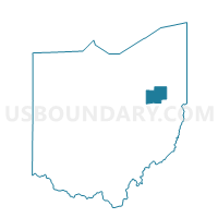
Outline

Summary
| Unique Area Identifier | 651899 |
| Name | BETHLEHEM TWP 1 Voting District |
| County | Stark County |
| State | Ohio |
| Area (square miles) | 0.10 |
| Land Area (square miles) | 0.10 |
| Water Area (square miles) | 0.00 |
| % of Land Area | 100.00 |
| % of Water Area | 0.00 |
| Latitude of the Internal Point | 40.73063080 |
| Longtitude of the Internal Point | -81.52515610 |
Maps


Graphs
Select a template below for downloading or customizing gragh for BETHLEHEM TWP 1 Voting District, Stark County, Ohio


Neighbors
Neighoring Voting District (by Name) Neighboring Voting District on the Map
- MASSILLON 5-D Voting District, Stark County, OH
- NAVARRE A Voting District, Stark County, OH
- NAVARRE B Voting District, Stark County, OH
Top 10 Neighboring County Subdivision (by Population) Neighboring County Subdivision on the Map
- Massillon city, Stark County, OH (32,149)
- Perry township, Stark County, OH (28,353)
- Bethlehem township, Stark County, OH (5,347)